Saturday, July 25, 2015

Green Mountain Trail: 07/24/15

Hike: Green Mountain


Date: 07/23/15

Distance/Gain: 
8.0 miles, 3,100 ft. of gain

Highest Point: 6500 ft

Rating: 7/10

Pros: Views, ponds, diverse plantlife/animal life

Cons: Crowds, for me fog


In preparation for my upcoming backpacking trip to Sahale Glacier, I decided that over the next few weeks I would be doing full backpacking weight (tent/bag/etc) for my day hikes.

I got an early start for this one, I woke up at about 4:15 and started getting ready.  I drove up hwy 530, and once past Darrington there was still a 20 mile drive up Suiattle River Road. The drive out is nice with very few potholes, and I actually made pretty good time up to the trail.  I arrived at the trail head around 8:30, and to my surprise there was another car already in the lot.  It was partially cloudy with fog, and I had high hopes that it would clear by the time I reached the top. I grabbed my gear, and began the slow trudge upward.

Plant "scree field"
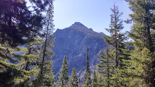
The hike starts out with the common theme in the area of switchbacks in heavy forest, only giving you an occasional peek view through the woods. I quickly came across some wood peckers, as well as grouse. After I cleared the woods, I began the walk down a level portion of the trail with about hip high plants on both sides of me. It is easy to see why this was named Green Mountain.  When the forest broke, I came upon at what on most hikes would likely have been a scree field, instead here is a sloped mountain side of all kids of hip high green plants, its pretty amazing to look at. I wondered to myself what types of creatures could be lurking around in there.  If you have acridophobia (fear of grasshoppers) then this is not the trail for you. One will jump sending off a chain reaction of about 50 more jumping on, and around you. 

I continued through more of the switchbacks, until I finally broke free and arrived at the ponds.  This is a very picturesque area, and is a great place for a break if you need one.

Once I left the ponds, I came across the open meadows in the green mountain basin. A look up ahead showed me what I was in for during my last 1000 ft to the top. With my full pack I was defiantly taking more short rests than I would have with my day-pack.

As I gained elevation I came to the disappointing conclusion that I was not going to have more than 100 yards of viability during this hike due to the clouds/fog. I was not going to get the views I desired, but at least I was still getting the workout that I needed.


I reached the top at 6500 feet, a new personal altitude record for my hikes, before heading back down.  I met my first set of hikers about 20 minutes down the trail.  We talked for a minute before a marmot screamed at us to get off of his doorstep, I obliged and continued on.


At that point the hike became bittersweet.  As I continued down and began to see some amazing views...the clouds and fog were lifting. I can only imagine what  I could have seen at the top if I had just waited an hour.  I passed about 5 sets of hikers on the way back to my car, seemed pretty busy for a Thursday, but this trail has something for everyone views, plant life, animals, insects, ponds, etc. 

 I would recommend this hike if you have the opportunity to try it.


Sunday, May 31, 2015

Diamond Head Hike (Oahu): 4/26/2015 (Late Blog Entry)

Hike: Diamond Head State Monument


Date: 04/26/2015

Distance/Gain:
1.5 miles, 560 ft. of gain

Highest Point: 761 ft

Rating: 7/10

Pros: Panoramic views, ease of hike

Cons: Crowds


Well this is a little different from my usual Washington State hikes, but Ill add it in as a Vacation hike.  While not the most taxing hike (more accurately a groomed walking path,) I have ever taken on, the 1.5 mile  560 ft of gain hike will work up a sweat, especially with the Oahu weather!  The drive to the trail head is a shore couple of miles out of town, and your drive up right into the crater.


The Diamond head hike has a nice easy elevation gain, with a switch back or two along the way.  The toughest part of the hike is the staircase (which you can chose to bypass altogether) that leads up to the main bunker.


You will encounter droves of other tourists, wearing anything from dinner clothes to trail running gear, and everything in between.  If you are searching for solitude hiking Diamond head will not provide it, however the people watching can be entertaining in itself.

When its all said and done, its a must do "hike" if you are ever in Oahu. And its cool to think that you are hiking up an old Volcano crater/ converted military base.  But I will take my Washington State solitude 99 times out of a 100!


Get out there!


Saturday, May 30, 2015

Colchuck Lake: 5/28/15

Hike: Colchuck Lake


Date: 05/28/15

Distance/Gain: 
8.0 miles, 2,280 ft. of gain

Highest Point: 5580 ft

Rating: 8/10

Pros: Beautiful lake, scenic hike, access to fresh water

Cons: Crowds (On weekends), distance to drive to.


After attempting Damfino lake to Excelsior ridge last week without success (lost trail in the snow,)  I decided I needed to get my first full hike of the summer out of the way.  I woke up at 4:45 am and chose Colchuck lake as my destination, and for my first taste of the "Enchantments."

As far of a drive as it was (about 2hrs 45 mins,) there is something fun about getting up at the crack of dawn, and driving across the pass for a solo hike. I cant accurately put it into words, but everyone should try it if you have the chance.

I arrived at the trail head at 9:00 to a semi full parking lot.  I had flashbacks to a post I read on NWhikers.net, about running into 100+ people on this same trail on memorial day weekend. At about 9:10 I was on my way up the trail.

The hike starts out with an easy mile and a half, creek side walk through the forest.  About a mile in, I passed a couple that were taking in the views of the creek.  To my surprise, those would be the only people that I passed on the way to the lake.  After the walk through the woods, you will cross the creek on a bridge before beginning the first real incline of the hike.

After a series of rocky switch backs you will reach the trail junction for Stuart, and Colchuck lakes.  To me this is where the hike really shined.  Stick to the left and you will happen upon another log bridge, with a talus field/forest layer/and the top of Dragontail peak all stacked up in front of you, it is an amazing view, almost like the gateway to the wilderness.

You stick to the right after crossing the bridge, and walk along the creek before your next big push uphill. The climb remains pretty consistent rocky, and rooty but very manageable.  You will have a few nice views/photo opportunities on your way to the lake.

1 hour and 50 minutes later I reached Colchuck lake.  The lake is just as awesome as advertised. A beautiful blue/green with Dragontail peak towering behind it.  I was able to spend about 30 minutes alone at the lake before I had to start heading home.  On the walk down I passed numerous groups of hikers (maybe a total of 15.) I reached my car exactly 3hrs and 50 minutes from when I left, making it a relatively quick and easy day hike.


Thursday, January 15, 2015

Ebeys Landing: 1/14/15

Hike: Ebey's Landing


Date: 01/14/2015

Distance/Gain:
5.6 miles, 260 ft. of gain

Highest Point: 260 ft

Rating: 7/10

Pros: Views, mix of beach/farmland/historical buildings, ease of hike

Cons: Not a challenging trip, crowds


I was made aware of this hike 2 years ago from an article in the Everett herald, and had put it on my list for a day where I wanted a hike with a big payout without having to put in much effort to get it, and that is exactly what I got.  

I woke up at 04:30 with every intention of driving to Mount St. Helen's to do the Boundary west hike.  I got up, had my pre-hike/workout shake, and promptly decided it I would take my first week off of hiking since the end of October.  The idea of driving 3.5 hrs each way to Mt. St Helens just wasn't going to work for me.

So with the wife at work, and nothing else to do, I continued to sleep in until 10:30.  When I woke up it was a sunny clear day outside, and I knew that I could not pass up this good weather.  I quickly gathered my gear, and got on the road.  Even though the drive is 1.5 hrs, it doesn't feel like it because you get great scenery along the way with driving past Anacortes, over deception pass, and through Whidbey island, there is never a dull moment.

I arrived at the Prairie overlook trail head at 13:00, which is way later than I am usually comfortable starting my hikes, but I knew that this one would be quick.  There were about 5 other cars at the trail head when I got there.

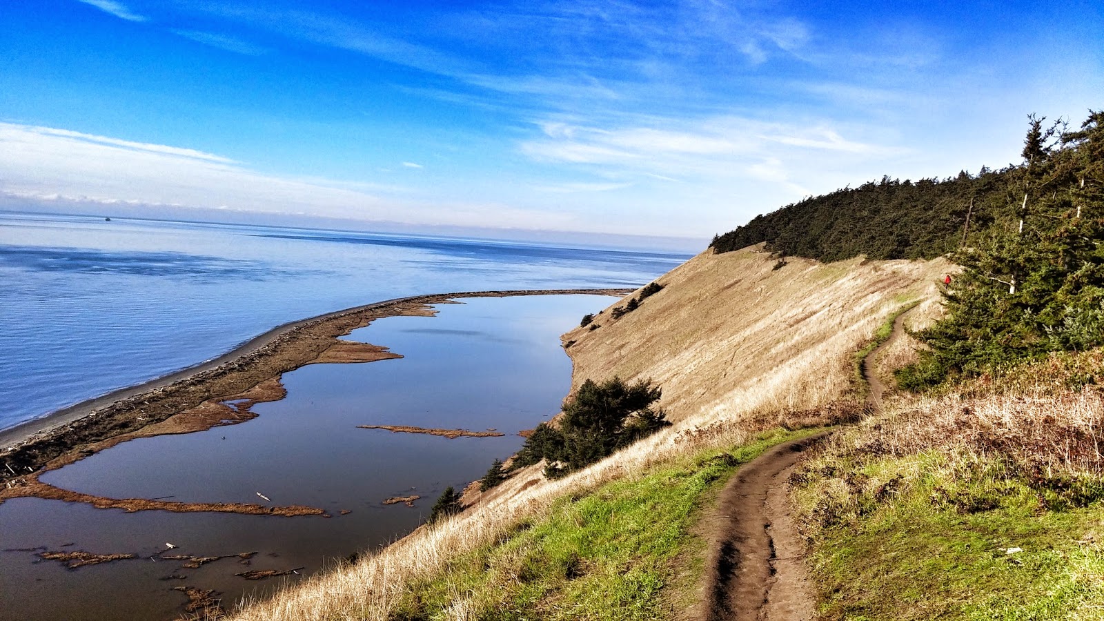
The hike starts off with a nice fence line walk in farmlands.  You quickly arrive at a couple of historical buildings that you can explore if you want.  You then gain views of the Sound, and can easily see Mt Baker, Rainier, and the Olympics with a simple turn of the head.

After a short walk you will arrive at a "T" junction in the trail, to the left is the beach portion of the hike and the lower parking lot. And to the right is a short trip to the summit, and the upper portion of the trail, either way the trail loops so it doesn't really matter where you go.  I however chose to go the the right, up to the "summit" at a lung shearing/quad burning elevation of 260 ft.  Ok, so its not a sweat breaker, but it still makes for a rewarding hike with great views.

You continue along the bluff trail, with a decently steep drop to your left side.  The trip is picturesque, where you enjoy views the entire time.  Once you get to the end of the upper trail there is a sign nice enough to tell you "End of trail," where you can either retrace your steps back along the upper bluff trail, or take the switchbacks down to the beach.

I took the beach trail back, its a nice peaceful walk with no obstacles to speak of, just a beach walk. Roughly 2 miles down the beach you will arrive at the lower parking lot, where you will link back up with the upper bluff trail, which is slightly down hill from where you started.

After a short climb arrive back at the Prairie trail junction, where you will take a right back towards the parking lot.

As I said, its not a tough hike by any stretch of the imagination. Its perfect for an "active rest" sort of day from mountain hiking, with a big visual payout.


Thursday, January 8, 2015

Thunder Knob hike: 01/07/15

Hike: Thunder Knob

Date: 01/07/2015

Distance/Gain: 3.8 miles, 635 ft. of gain

Highest Point: 1875 ft

Rating: 6/10

Pros: Views, solitude, ease of hike

Cons: Blow downs, drive distance, many man made items in view.


After seeing that this was WTA's hike of the week, and with how much I love the North cascades, I decided this would be the hike for me. We got an early start on the road because it was a 1.5 hr drive. The road was bare/wet with no real issues, however HWY 20 is shut down just 4 miles up the road due to a slide.

The trailhead was vacant when we got there. We quickly geared up and began walking in 3" of snow that continued to get deeper from the parking lot. Following my GPS we quickly met a 6 foot wide stream that had about 8-10" of quick moving water. After trying some different crossing methods, we headed closer to the lake (Diablo) and found a snow covered log that seemed suitable.


After crossing you make your way through more snow to another stream crossing. This one was doable with some careful rock hopping. Once you find the trail through the 5" of snow, it is pretty easy to follow, even though there were no tracks from other hikers in it. There is enough melted spots to guide you the right way.

The trail has a few minor switch backs, but nothing to break a sweat over, and there are enough peek views to keep the trail entertaining. 

Once you get to the pond, the trail continues to the left, and wraps around the back of the pond, It is just a short walk from there to the first of two view points where you can see: Diablo Lake, the McMillan Spires, Stetattle Creek valley, etc. 


Continue down the trail to the final view point where there are more benches, and you can see Jacks Mountain, and HWY 20 winding through the Mountains ahead.

Heading back was an easy walk, and to our surprise we encountered a group of about 8 heading up the trail.

Overall this is a very easy hike. We never put on our spikes, or gaiters. The gaiters wouldn't have hurt, but they just went needed the day we went. As always be prepared and pack what you may need.


Sunday, January 4, 2015

Winter day hike gear list

Gear list: Winter day hikes


This is a list of gear that I carry as a predominantly solo-hiker in the winter in the Washington Cascades. Its light enough for me to quickly and safely navigate most things that I will encounter in my area.

That being said, every hiker will have different needs and comfort levels. If you if are comfortable barefoot in a loincloth, or want to bring a full 50lb expedition pack then do it. Do what works for you. If you have any suggestions or input, feel free to comment below!

Prices may not reflect actual market cost, when possible I attempt to buy on sale or used.

Items worn or carried will not be listed in total pack weight.

Gear and accessories Item Weight Price
Backpack Geigerrig Rig 700 42.4oz $30
Glove Liner Columbia Omni-heat grip gloves 1.2oz $20
Glove Shell Mountain Hardware Plasmic Gloves 2.5oz $49
Knife Cold Steel Spartan 9.2oz (carried) $68
First aid Adventure Medical Pocket Medic 3.2oz $10
Emergency Bivy SOL Bivy 4oz $15
Mini survival kit Lighter, water tabs, whistle, etc 5.5oz N/A
Balaclava* Polarsport fleece balaclava 2oz $15
Traction* Kahtoola Microspikes 12.5oz $64
Gaiters* Tubbs Gaiters 5.6oz $29
Subtotal 4.93 lb $300
Clothing (Worn not packed) Item Weight Price
Rain Shell Mountain Hardware Sirocco NA $99
Boots Merrell Reflex II Waterproof Boots NA $70
T-Shirt Patagonia Fore Runner T-shirt NA $39
Beanie Under Armour Coldgear "storm" Infrared Beanie NA $20
Base Layer bottom Paradox merino blend pant NA $17.99
Base Layer top Paradox merino blend 1/4th zip top NA $17.99
Pants The North Face Paramount Peak 2 NA $85
Socks Simms ExStream wading sock NA $30
Mid layer* Eddie Bauer Cloud Layer Pro Fleece 1/4-Zip NA $49
Subtotal NA $437.98
Electronics Item Weight Price
Personal Locater Beacon SPOT Gen 2 5.2oz $45
Phone/Camera/Music LG-G3 5.26oz $99
Watch Suunto Advizor 1.9oz $99
GPS Backcountry Navigator APP (On phone) 0oz $11
Headlamp Black Diamond Spot 3.2oz $22
Backup phone battery Generic 3300mah battery 2oz $13
Subtotal 1.09 lb $289
Food Item Weight Price
Water 2 Liters w/camelbak elixir tabs 4.4lbs N/A
Clif bar x1 2.4oz $1
Clif shot bloks x1 2.1oz $2
Peanut butter sandwich x1 4oz N/A
Subtotal 4.93 lb $3
Totals Item Weight Price
10.95lb $1029.98
* Trip condition dependent item

Instagram